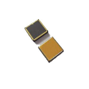
High Precision Navigation MEMS Gyroscope

Апісанне тавару
Introduction
ER-MG2-300/400, a Navigation Grade MEMS gyro sensor up to 400deg/s measurement range and 0.05°/hr bias instability, is specially designed for precision attitude & azimuth measuring, positioning, navigating, guidance in high performance IMU /AHRS/ GNSS-aided INS, aerial/marine/land mapping/survey system/UAV/AUV and navigation grade MEMS weapon system.
With the high dynamic measurement range and high precision, ER-MG2-300/400 is a cost effective, robust, reliable, small size, light weight, low power, most suitable replacement of medium-low navigation grade FOG/DTG with high dynamic azimuth & attitude measuring , inertial positioning and navigation function in aerial, marine manned, or unmanned carriers.
The ER-MG2-300/400 High Precision Navigation MEMS Gyroscope is a single-axis MEMS angular rate sensor (gyroscope), capable of measuring angular velocity up to a maximum of ±400°/s with digital output compliant to SPI slave mode 3 protocol. Angular rate data is presented as a 24-bit word.
The ER-MG2-300/400 with an advanced, differential sensor design rejects the influence of linear acceleration, enables to operate in exceedingly harsh environments where shock and vibration are present.
The ER-MG2-300/400 is available in a hermetically sealed ceramic LCC surface mount package, and is capable of operating at 5V supply and a wide temperature range (−40°C to +85°C).
Features
Proven and robust silicon MEMS gyro
Up to ±400°/s measurement range
0.03-0.05°/hr bias instability
0.01-0.025°/√hr angular random walk
Digital output (SPI slave)
5V operation (4.75~5.25V supply)
Low power consumption (40 mA)
High shock and vibration rejection
Hermetically sealed ceramic LCC surface mount package (11x11x2mm)
Integrated temperature sensor
RoHS compliant
Application areas
Precision attitude & azimuth keeping, positioning, navigation in navigation grade IMU/INS/AHRS
Heading, navigation, positioning in High performance GNSS-aided INS
Orientation, navigation, positioning in aerial/marine/land mapping/survey system
Attitude and motion control in medium and large UAV, AUV
Pointing and tracking in satellite antenna,target tracking system
Guidance and navigation in medium-low navigation grade MEMS weapon system
Azimuth, position, heaving/swaying/surging of gyrocompass in surface and submarine carriers, AUV
Antenna and Line of Sight Stabilization Systems
Integrated Navigation Systems & Inertial Guidance System
Flight Control & Guidance System
Attitude Heading Reference Systems (AHRS)
Stabilization of Antennas, Cameras & Platforms
Aerial and Marine Geo-mapping / Surveying

